The hill country around Gisborne doesn’t forgive assumptions. With weathered Miocene mudstone and sandstone dominating the terrain, and an average annual rainfall exceeding 1,000 mm concentrated in winter cyclonic events, pore-water pressure build-up is a primary trigger for instability. A slope stability analysis here has to account for more than just geometry—it must integrate the region’s high-erodibility soils, the legacy of historic landsliding across the Waipaoa catchment, and the way east-coast storms saturate colluvium in a matter of hours. We routinely combine deep CPT testing to map shear-strength profiles with borehole SPT data so the model reflects actual subsurface layering, not textbook assumptions. In a district where pastoral slopes meet urban expansion above the Poverty Bay flats, getting the factor of safety right is what keeps subdivision earthworks and road batters stable through the wet season.
A slope stability analysis in Gisborne that ignores antecedent rainfall and residual strength parameters is a slope waiting to fail during the next east-coast storm.
Technical details of the service in Gisborne
Demonstration video
Local geotechnical conditions in Gisborne
Gisborne sits at 38.66° south, directly exposed to the Pacific cyclone corridor. The 2020 flooding event that cut SH35 and triggered hundreds of shallow landslides across the region was a blunt reminder: slopes that looked stable in February failed in July when antecedent moisture pushed soil suction to zero. This city’s residential fringe is climbing into terrain where 15° to 25° slopes are common, and where even a 1.5-metre cut can daylight a weak bedding plane. A slope stability analysis is not a paperwork step—it is the difference between a consented subdivision and a costly remediation after the next heavy-rainfall event. We model both drained and undrained conditions, applying NZGS guideline parameters for residual strength in remoulded soils, and we include seismic loading per NZS 1170.5:2004 because the Hikurangi subduction zone is capable of generating a magnitude-8.0 earthquake less than 100 km offshore. Ignoring that combination of high groundwater and seismic demand has led to failures in Gisborne that engineers still reference in regional case studies.
Our services
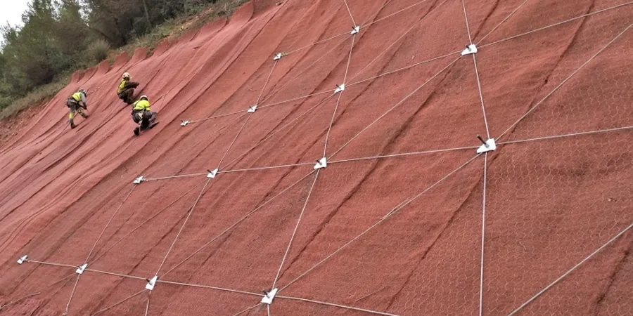
Our slope stability work in Gisborne covers everything from preliminary desktop assessments for resource consent to detailed design for engineered fills and cut slopes. Each investigation includes the field and laboratory data that the stability model actually needs.
Detailed Slope Stability Assessment
Limit-equilibrium modelling of natural and engineered slopes, integrating CPT, SPT, laboratory shear-strength testing, and seasonal groundwater monitoring. Suitable for subdivision earthworks, road batters, and hillside building platforms in the Gisborne hill country.
Stabilisation Design & Peer Review
Design of retaining structures, drainage systems, and ground-anchor layouts to achieve target factors of safety in landslide-prone terrain. We also provide independent peer review of third-party stability analyses for council submission, referencing local failure case histories where relevant.
Frequently asked questions
What does a slope stability analysis in Gisborne typically cost?
For a residential or small subdivision slope in the Gisborne area, a complete assessment—including targeted drilling, laboratory testing, and limit-equilibrium modelling—typically falls between NZ$2,140 and NZ$7,900. The spread depends on slope height, access constraints, number of cross-sections required, and whether seasonal groundwater monitoring is needed to satisfy council conditions.
When does Gisborne District Council require a slope stability report?
Under NZS 4404:2010 and the council’s earthworks consent triggers, a slope stability analysis is generally required for cuts or fills exceeding 1.5 m in height, any earthwork on slopes steeper than 15°, and building platforms within the ‘hill country’ or ‘coastal erosion’ overlays shown on the district planning maps.
How do you account for earthquakes in a Gisborne slope assessment?
We derive the horizontal seismic coefficient from NZS 1170.5:2004, using the site subsoil class determined by CPT or borehole shear-wave velocity data. Because Gisborne sits above the Hikurangi subduction zone, the analysis often includes a sensitivity check at a higher seismic demand to ensure the slope retains adequate post-earthquake integrity.
What’s the difference between a desktop assessment and a detailed analysis?
A desktop assessment uses existing geological maps, aerial photographs, and published geotechnical data to screen for obvious hazards—useful for early feasibility. A detailed analysis adds site-specific drilling, laboratory shear-strength testing, and numerical modelling to calculate a quantifiable factor of safety. Council almost always requires the detailed version for consent lodgement.